Maps of Red Hook
Click on the images to view larger versions. Note: Before the Town of Red Hook was established in 1812, it was a part of Rhinebeck, as shown in the 1797 Thompson maps. Also note that the four versions of the Thompson maps contain different details.

1789 From Poughkeepsie to Albany
By Christopher Colles, David Rumsey Historical Map Collection
1795 Plan of Tivoli
Commissioned by Peter Delabigarre, Collection of the Village of Tivoli, Found at The Pynes, Courtesy of Nancy Houk
1797 Rhinebeck
Surveyed by Alexander Thompson, Collection of Bard College, Montgomery Place Campus
1797 Rhinebeck
Surveyed by Alexander Thompson, Collection of Library of Congress
1797 Rhinebeck
Surveyed by Alexander Thompson, Collection of NY State Archives
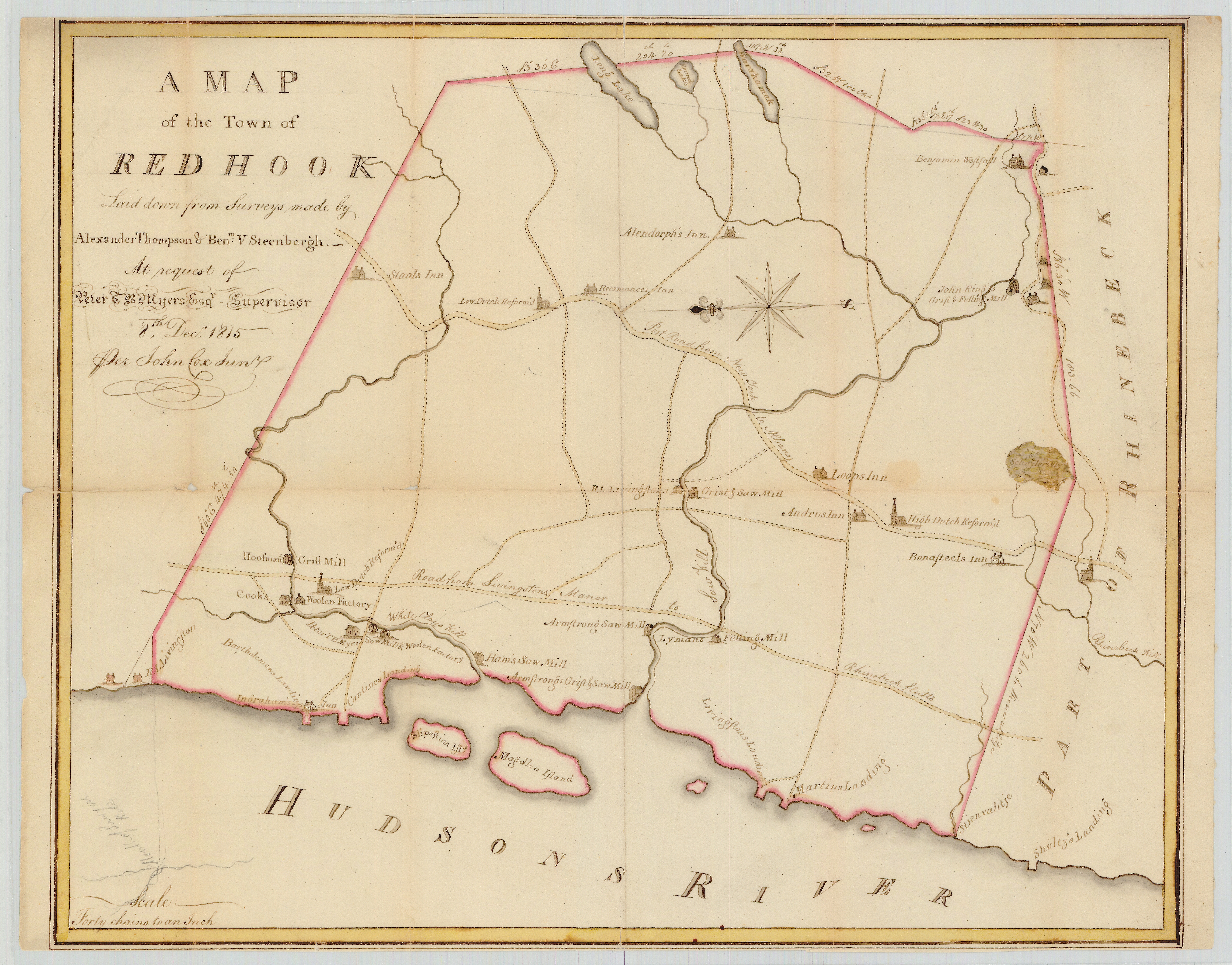
1815 Red Hook
Surveyed by Alexander Thompson and Benjamin Van Steenbergh, drawn by John Cox Jr.
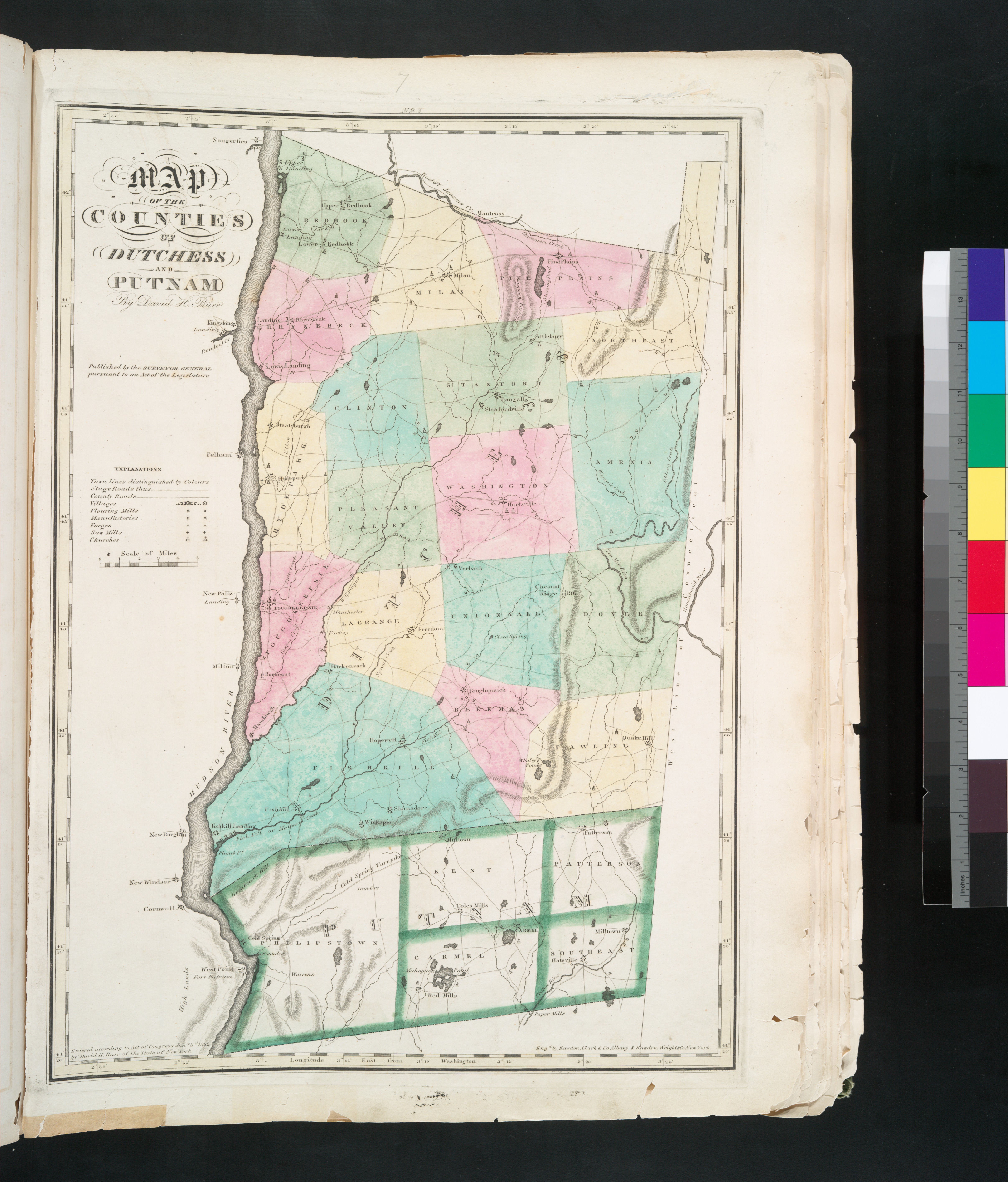
1829 Dutchess County
By David H. Burr and Simeon De Witt, Collection of NY Public Library
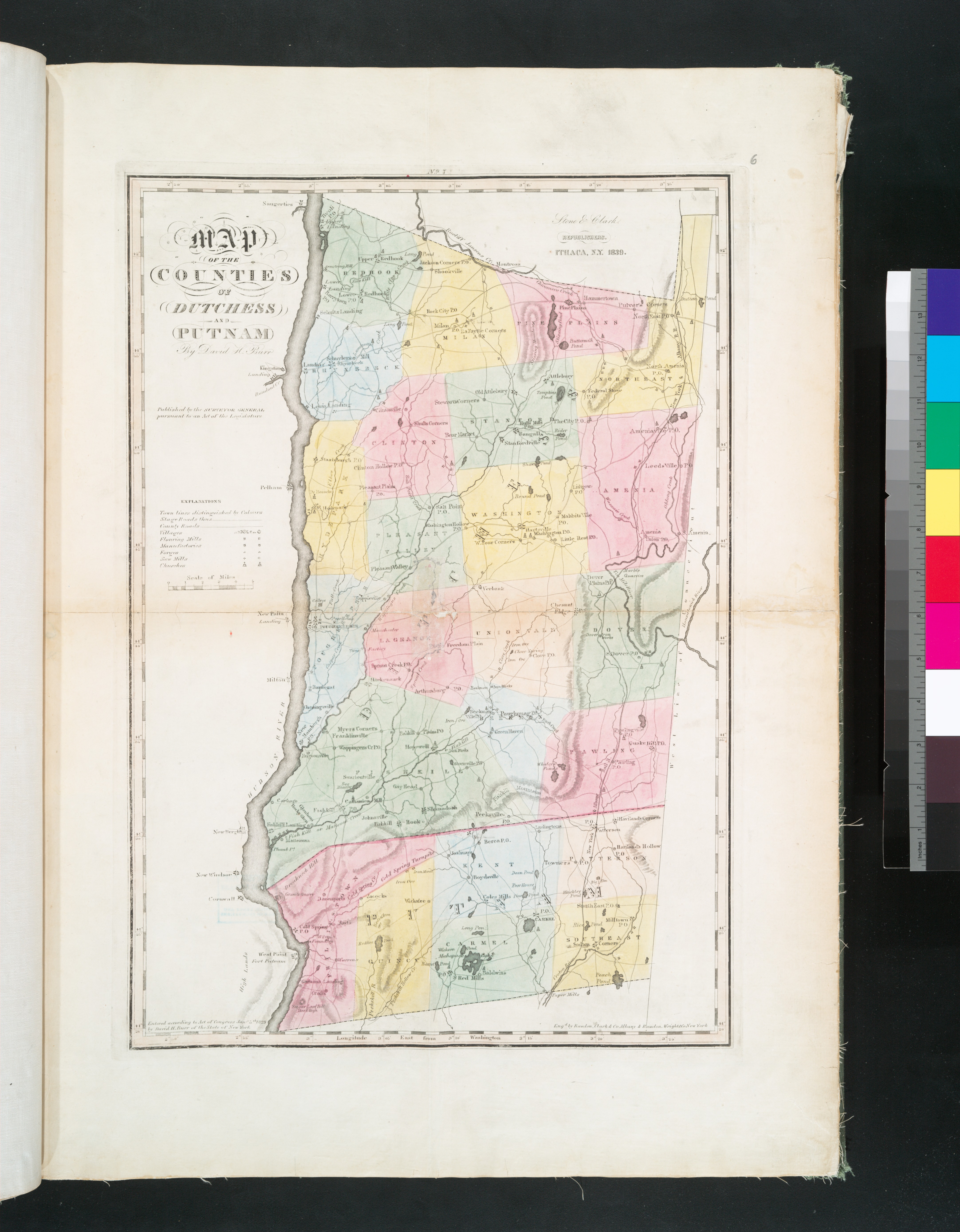
1839 Dutchess County
By David H. Burr and Simeon De Witt, Collection of NY Public Library

1850 Dutchess County
Published by John E. Gillet, Collection of the Library of Congress
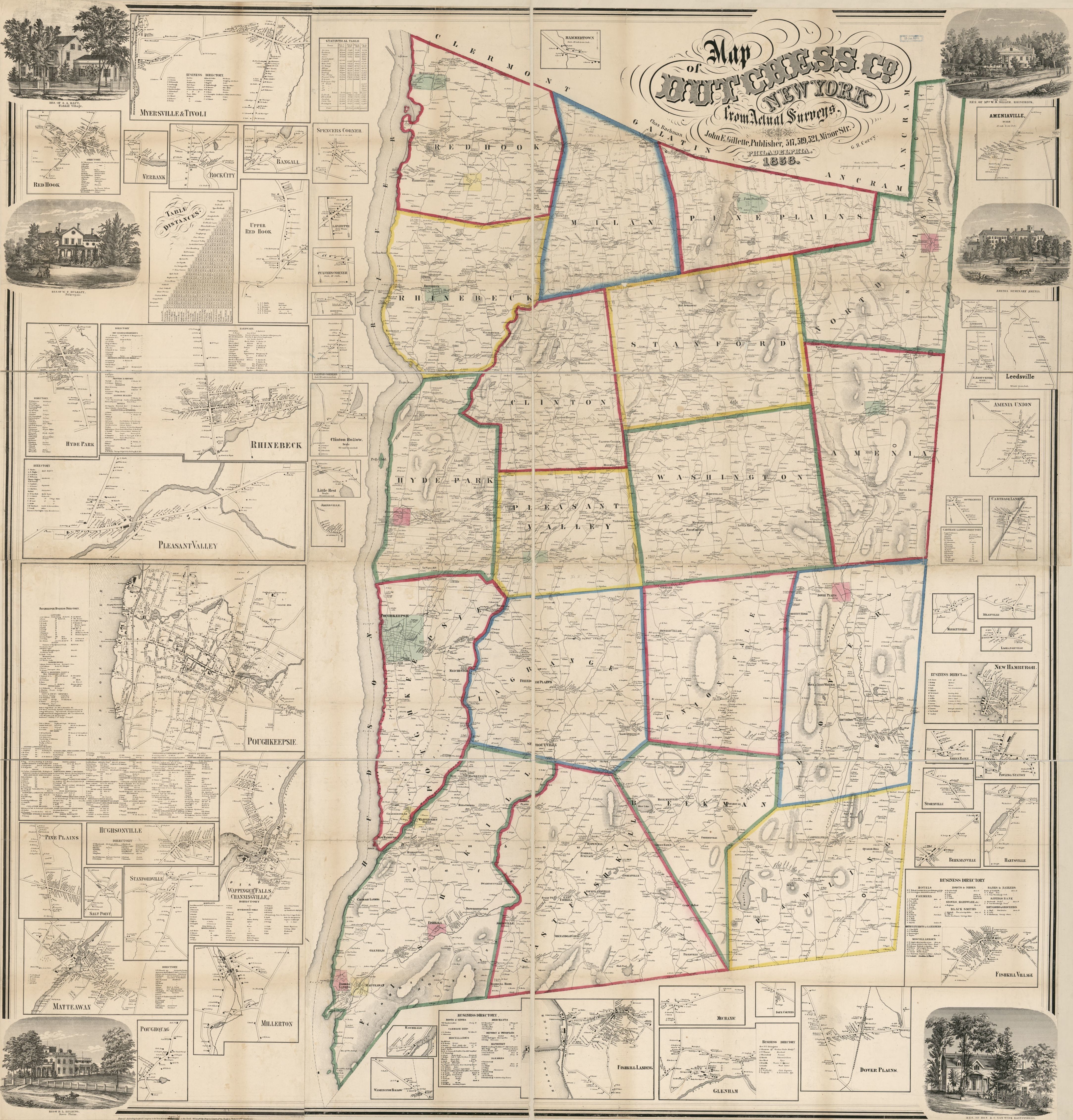
1858 Dutchess County
By John E. Gillette, Collection of Library of Congress
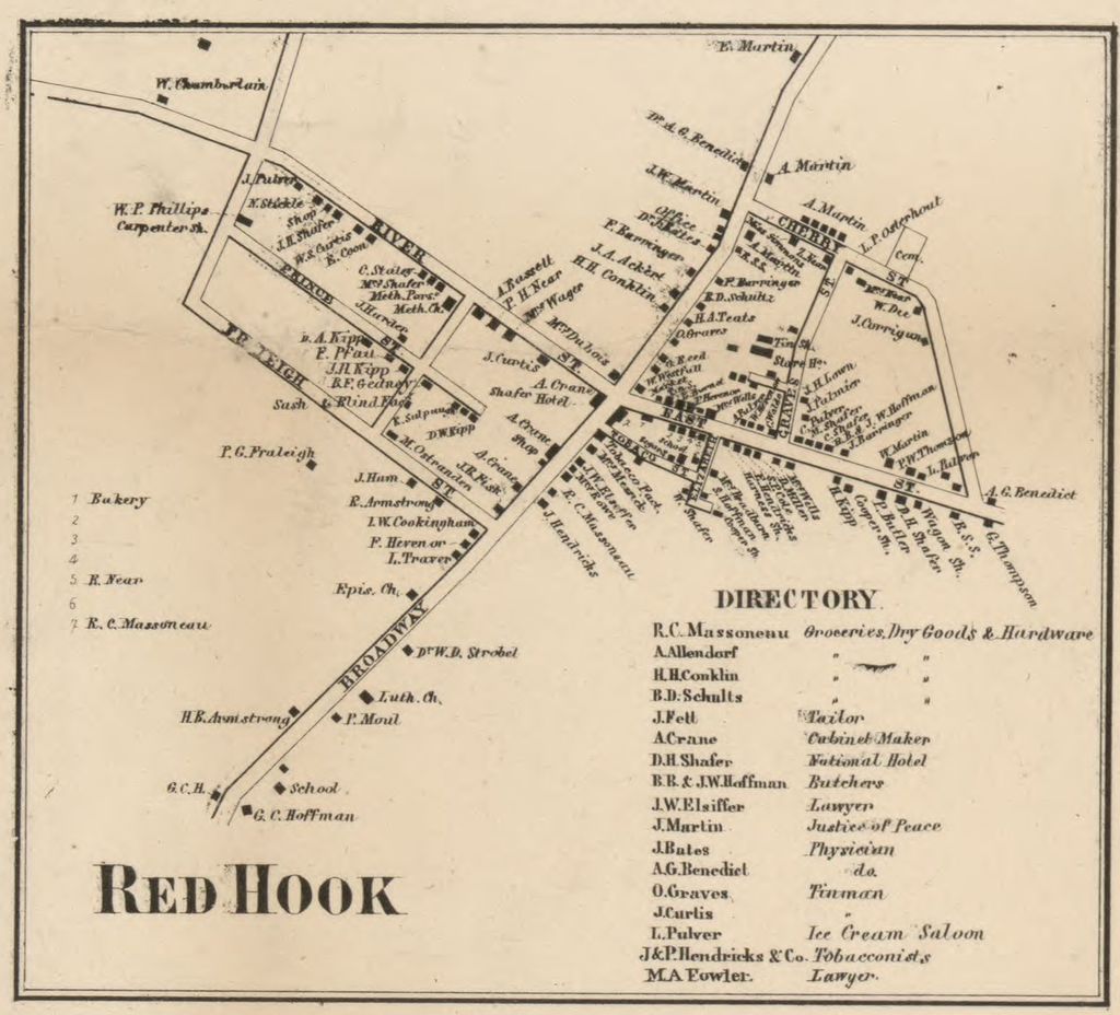
1858 Village Red Hook
Detail from John E. Gillette Map of Dutchess County, Collection of Library of Congress
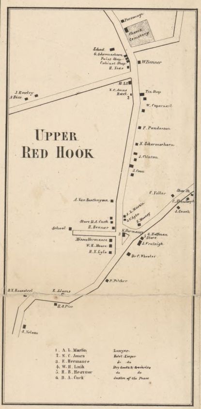
1858 Upper Red Hook
Detail from John E. Gillette Map of Dutchess County, Collection of Library of Congress
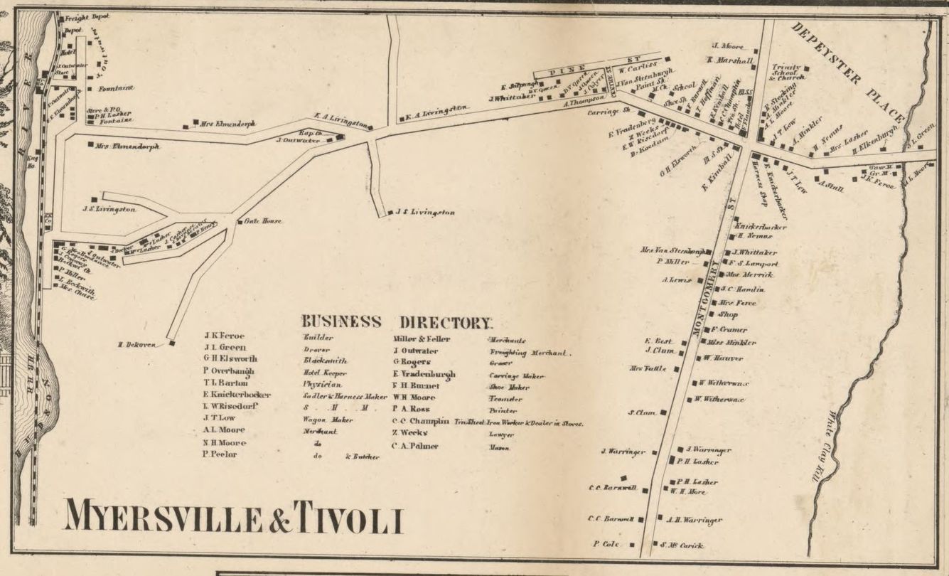
1858 Tivoli
Detail from John E. Gillette Map of Dutchess County, Collection of Library of Congress

1867 Red Hook
By Frederick W. Beers, David Rumsey Historical Map Collection
1867 Village of Red Hook
By Frederick W. Beers, David Rumsey Historical Map Collection
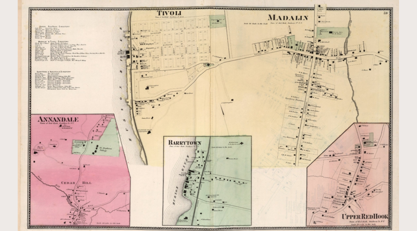
1867 Tivoli, Madalin, Annandale, Barrytown, Upper Red Hook
A map of the Village of Tivoli and other historic hamlets; By Frederick W. Beers, David Rumsey Historical Map Collection

1876 Dutchess County
By O.W. Gray & Son, Collection of NY Public Library
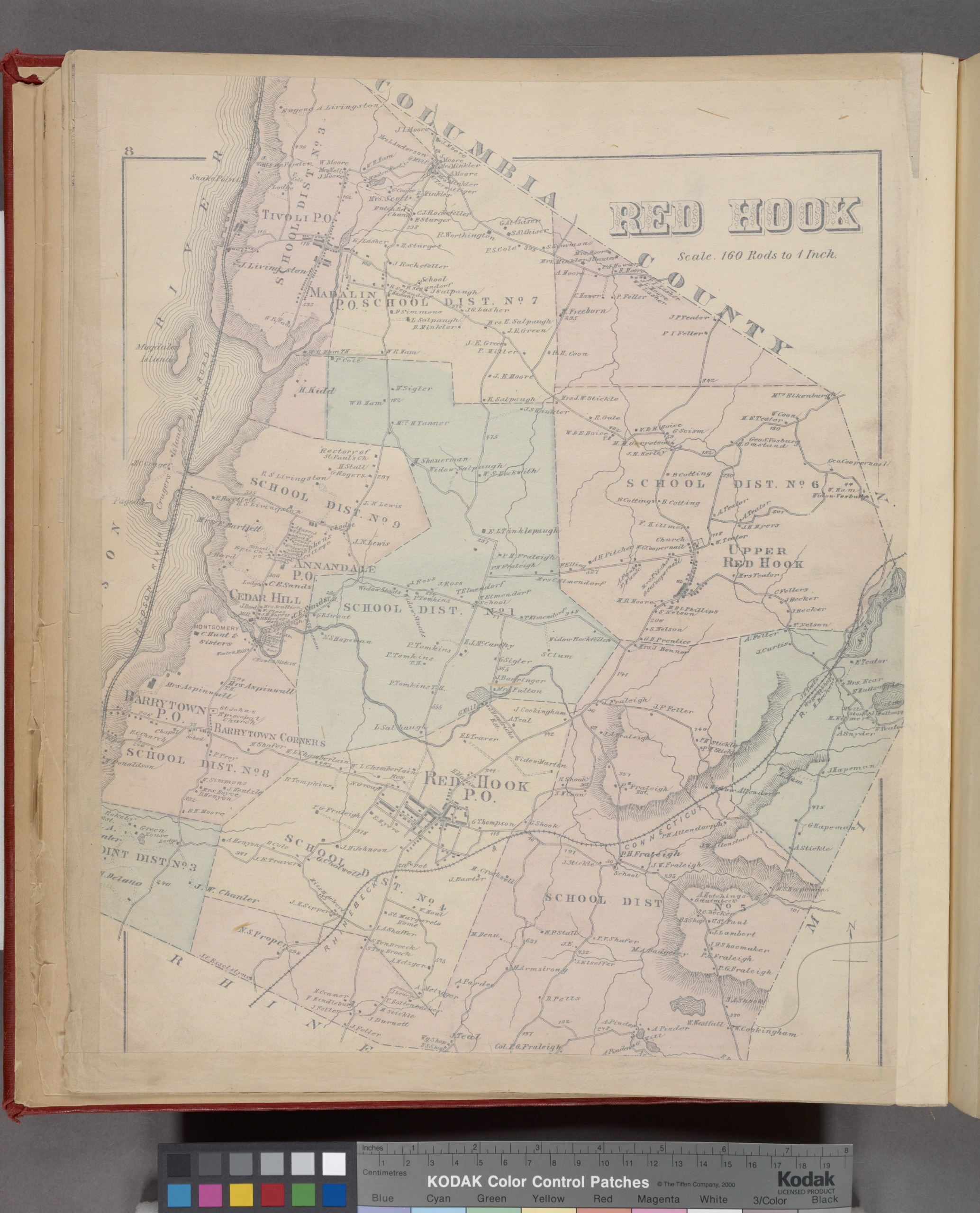
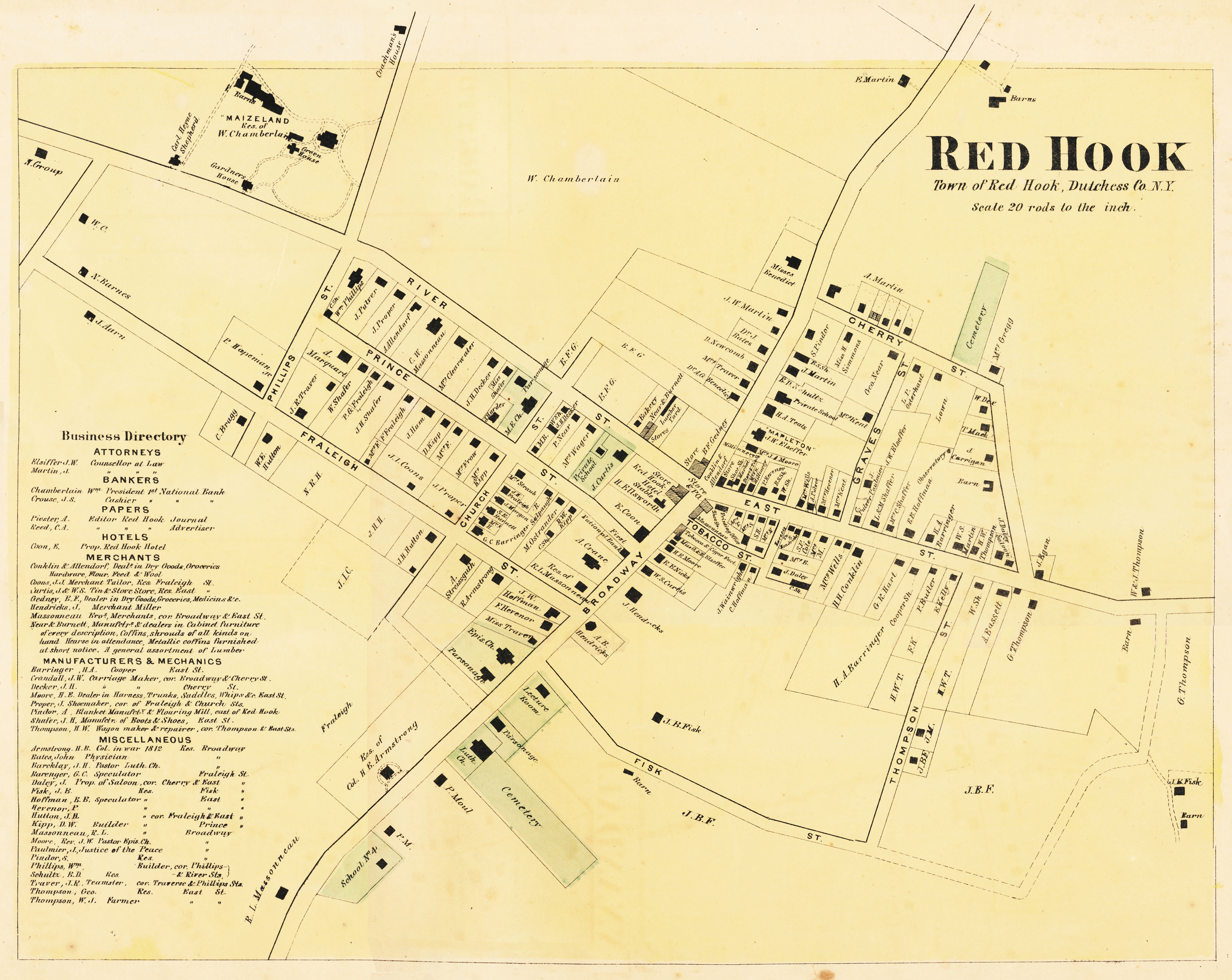
1876 Red Hook
By O.W. Gray & Son, Collection of NY Public Library
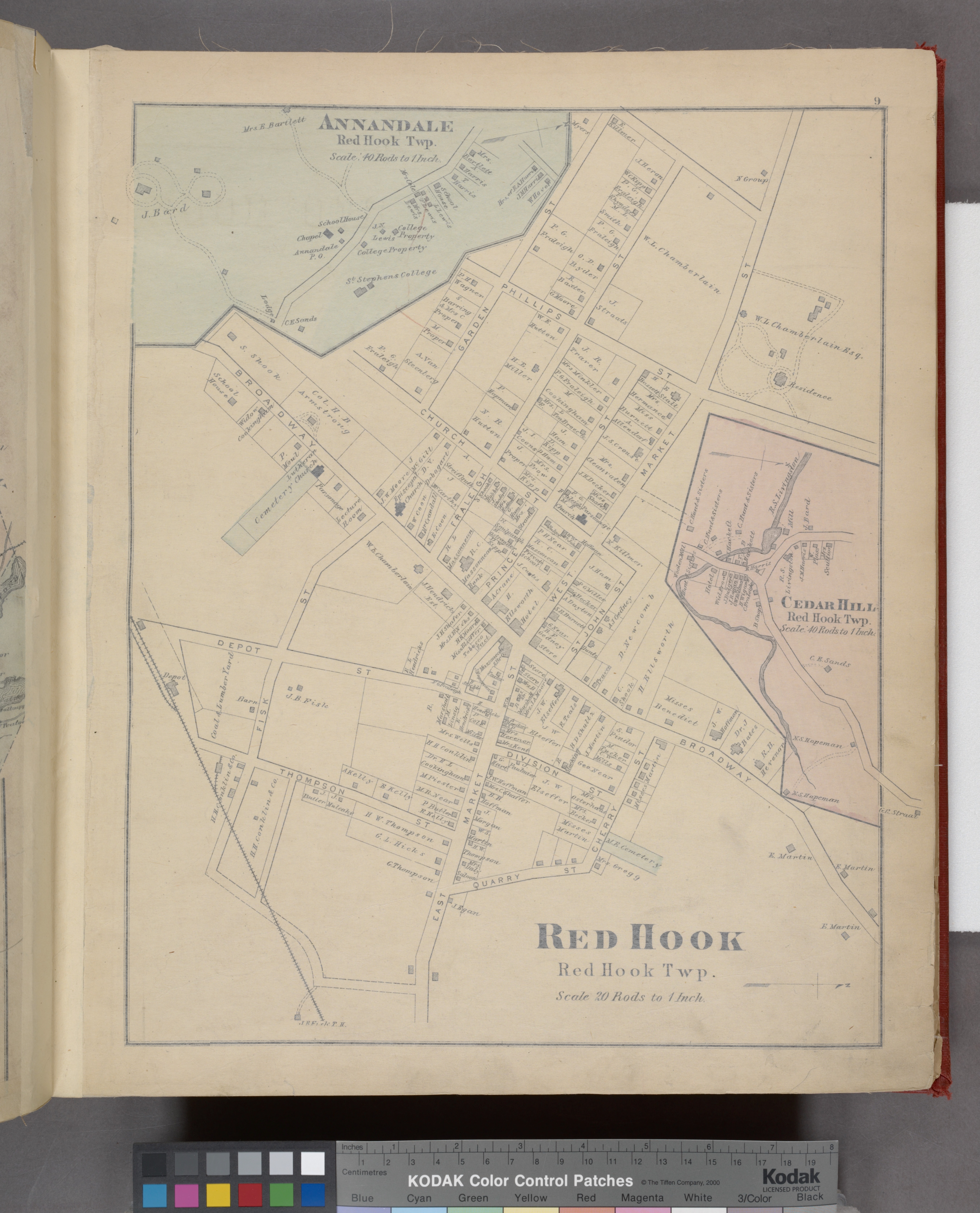
1876 Village of Red Hook, Annandale, and Cedar Hill
By O.W. Gray & Son, Collection of NY Public Library
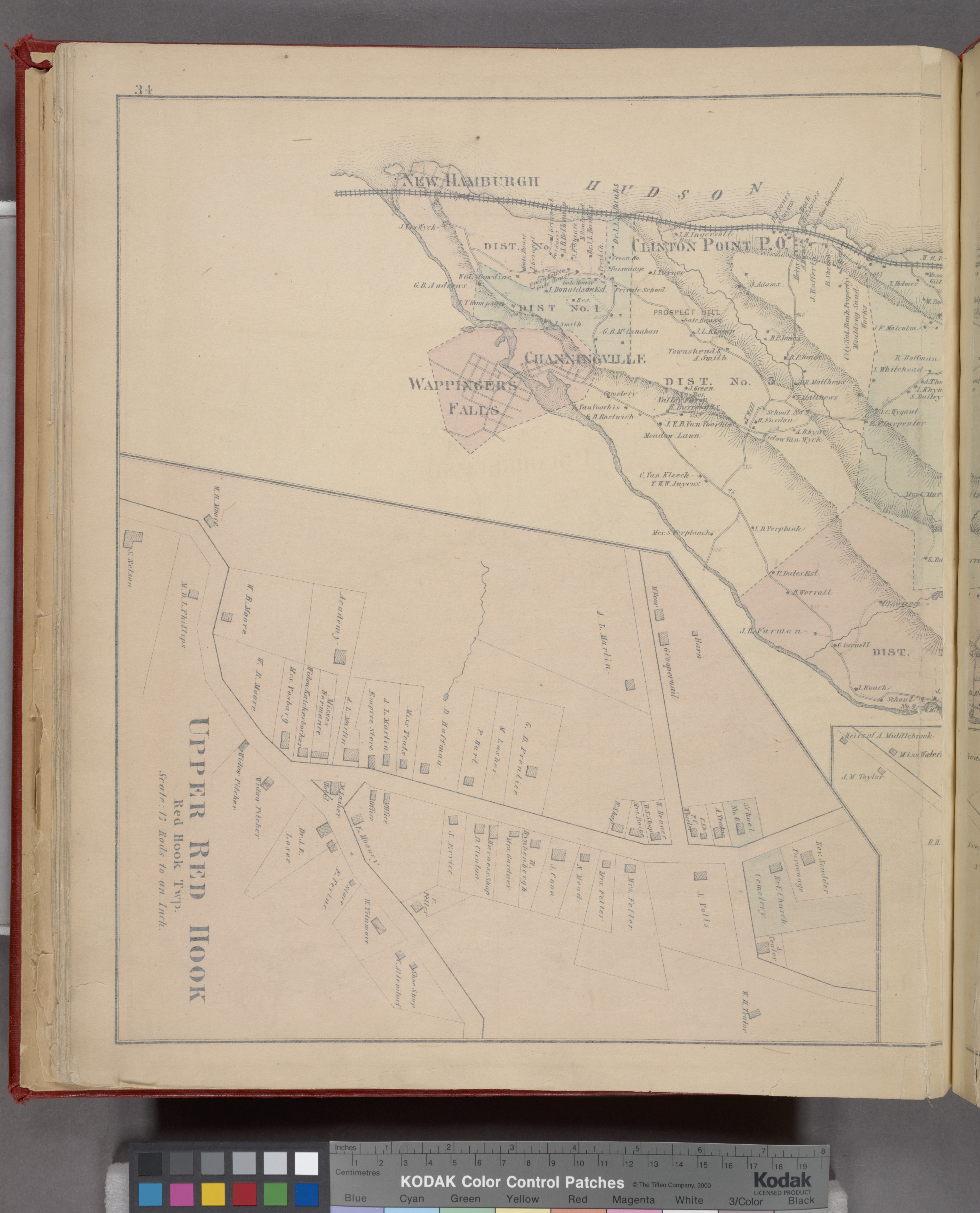
1876 Upper Red Hook
By O.W. Gray & Son, Collection of NY Public Library
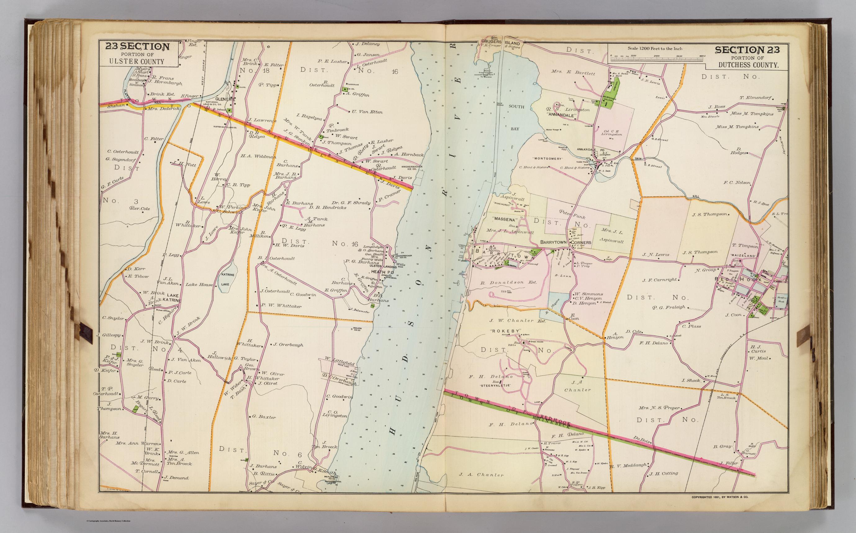
1891 Dutchess & Ulster Co.
By Frederick W. Beers, David Rumsey Historical Map Collection
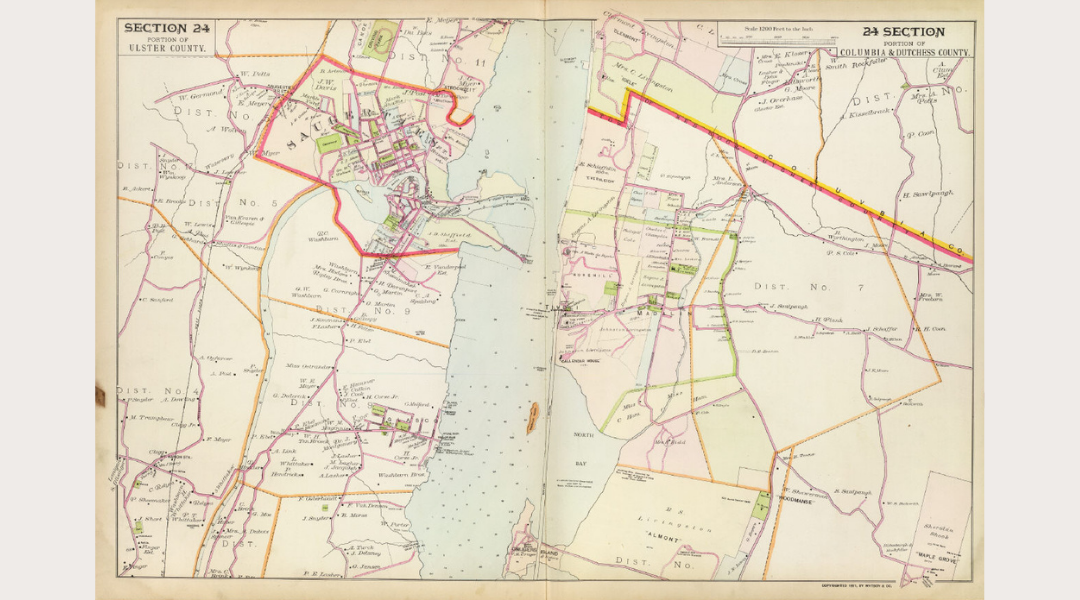
1891 Ulster, Columbia, and Dutchess Counties
By Frederick W. Beers, David Rumsey Historical Map Collection
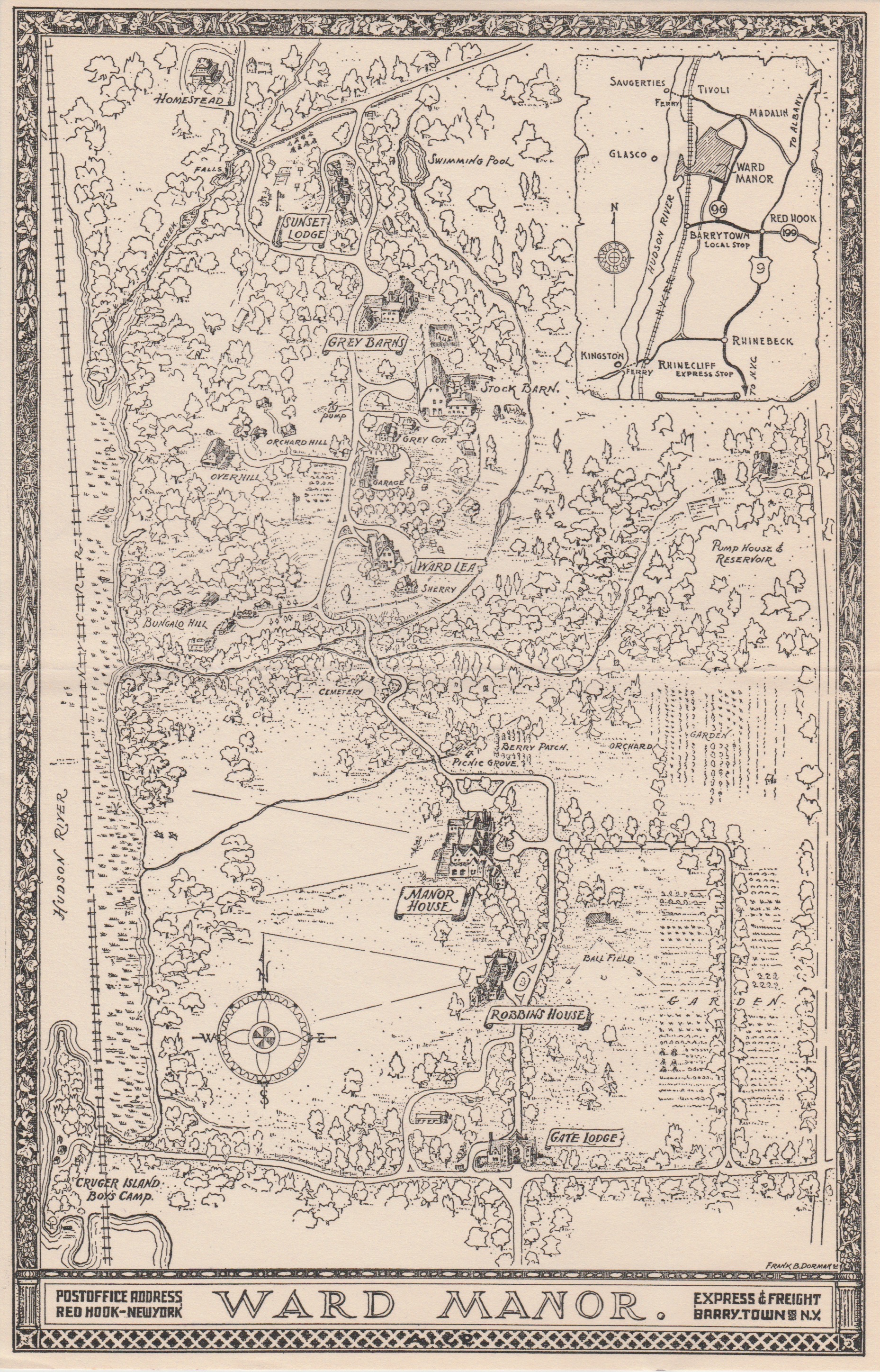
Ward Manor
By Frank B. Dorman, Collection of Emily Majer, Town Historian